That changing character is one of the easiest ways to understand why the Mahanadi matters to Odisha. It is not simply a river flowing from one point to another. Its water has influenced where people settled, how farmland was cultivated, where cities developed, how floods were managed and how communities built traditions around the river.
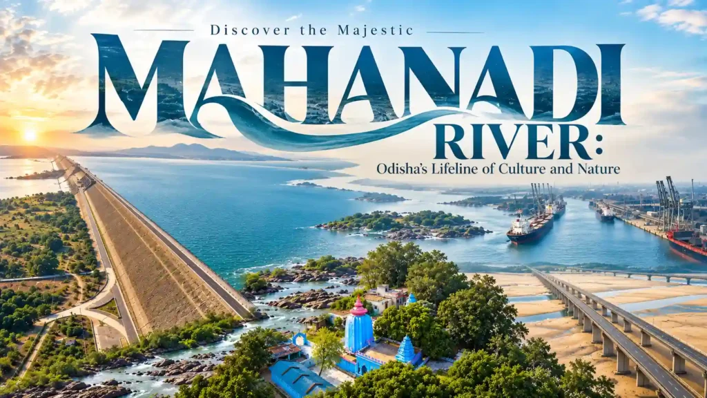
The Mahanadi is about 858 kilometres long, rising in present-day Chhattisgarh and flowing through Odisha before reaching the Bay of Bengal. Its basin extends across several states, while its tributaries and distributaries create a much larger geographical system than the main river alone suggests.
For visitors, this means there is no single “Mahanadi experience.” Hirakud tells one story. Sambalpur tells another. Cuttack reveals the river's role in urban history, while the lower delta shows how water and land have shaped coastal Odisha.
This article follows those connections through the river's mythology, history, geography, economy, ecology and the places where travellers can see different sides of it.
The Mahanadi in Mythology – Where Geography Becomes Tradition
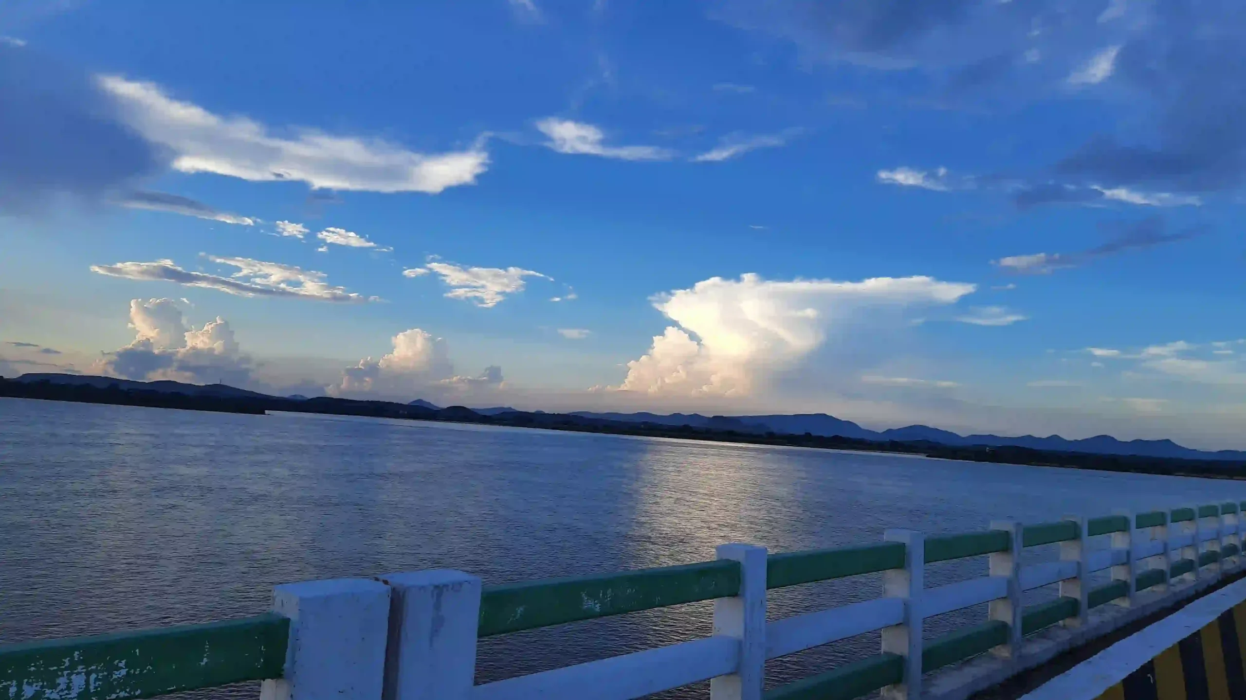
The Mahanadi has never been treated only as a geographical feature. Its course appears within religious traditions, local stories and the cultural memory of communities that have lived beside its waters.
The Parashurama Tradition
One traditional account connects the Mahanadi with Parashurama, the warrior sage of Hindu tradition. According to the legend, Parashurama created the river with a stroke of his axe. This is a religious tradition rather than a geological explanation for the river's origin, and keeping that distinction clear is important when discussing the Mahanadi.
Ancient traditions have also associated the river with names including Nilotpala and Mahasweta. These associations belong to the wider literary and religious traditions surrounding sacred geography in eastern India.
The River in Odisha's Living Culture
The Mahanadi's cultural relevance did not end with ancient traditions. Communities along its course continue to connect rivers, agriculture, seasonal cycles and religious observances.
In western Odisha, Nuakhai is particularly significant. The harvest festival is deeply connected with agricultural life, and the river systems of the region form part of the landscape in which that culture developed.
It is useful to separate folklore from documented history here. A river can carry a powerful sacred tradition even when the story behind that tradition cannot be established as a historical event. That does not make the tradition unimportant; it explains how people have understood the landscape around them.
What the Mahanadi Has Meant to Odisha Through History
The history of the Mahanadi is easier to understand when viewed through the settlements that grew around its water rather than through a list of dates.
River valleys provided access to water and fertile land, making them important areas for agriculture and settlement. In Odisha, the wider Mahanadi system became closely connected with towns, trading activity, political centres and cultural institutions.
Why Cuttack Became So Important
Cuttack offers one of the clearest examples of the river's influence on Odisha's history. The city developed within a landscape shaped by the Mahanadi and its distributaries. Its position gave it strategic value and helped make it an important political centre in Odisha.
The relationship between Cuttack and the river is therefore more than a matter of scenic views. The waterways influenced the geography on which the historic city developed.
Hirakud Changed the Modern Story
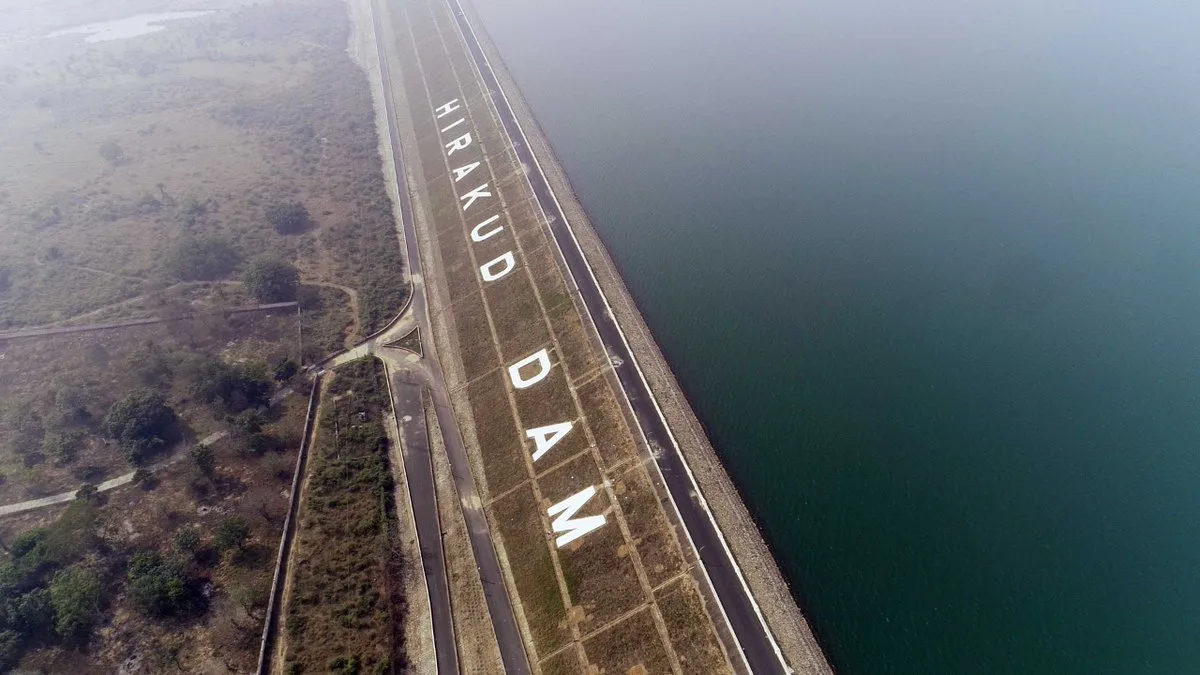
Hirakud Dam added a completely different chapter to the Mahanadi's modern history. The dam near Sambalpur was inaugurated in 1957 as a multipurpose project intended to support irrigation, flood control and power generation.
Its reservoir also changed the physical landscape around Sambalpur, creating a vast body of water that is now closely associated with the region.
The project demonstrates both sides of river management. A large river can provide enormous benefits when its water is managed for agriculture, electricity and flood protection, but decisions about that water also affect ecosystems and communities downstream.
Follow the Mahanadi on a Map and Its Story Becomes Clearer
Tracing the Mahanadi on a map reveals why its influence extends far beyond the places where the main river channel is visible. Its tributaries, reservoirs, distributaries and delta are all part of the same larger system.
Where Does the Mahanadi Begin?
The Mahanadi rises near the Sihawa hills in present-day Dhamtari district of Chhattisgarh. From its upper course, it travels through the plains before entering Odisha.
Several tributaries add to its flow along the way. Important tributaries of the Mahanadi system include the Seonath, Hasdeo, Mand, Ib, Ong, Tel and Jonk.
What Happens When It Enters Odisha?
In Odisha, the river becomes increasingly important to both the landscape and human settlement. It is associated with places including Sambalpur, Sonepur, Boudh, Banki and Cuttack.
The river does not remain a single, simple channel throughout its journey. As it moves toward the coast, it interacts with a network of distributaries and other waterways. This is particularly visible around Cuttack and the lower Mahanadi system.
How Large Is the Mahanadi Basin?
The Mahanadi basin covers roughly 141,600 square kilometres and extends across several Indian states. Odisha and Chhattisgarh contain the major portions of the basin, with smaller areas extending into neighbouring states.
This is why looking only at the main blue line on a map can be misleading. The Mahanadi is better understood as a river system: tributaries feed it, distributaries carry its water outward, and the delta connects the river with the coastal environment.
Why Odisha Depends on the Mahanadi
The river's importance becomes most obvious when the discussion moves away from tourism.
For millions of people, the Mahanadi system is connected to water for farming, electricity generation, fisheries, industry and domestic use. Its importance is therefore economic as much as cultural.
- Agriculture: Irrigation from the Mahanadi system supports farming across large parts of Odisha, particularly rice cultivation.
- Power generation: Hirakud and associated infrastructure use the river's water resources for hydroelectric generation.
- Fisheries: Rivers, reservoirs and connected wetlands provide fishing opportunities and support related livelihoods.
- Wetlands and wildlife: Riverine and wetland habitats support fish, birds and other species across different parts of the basin.
- Industry and settlements: Reliable water resources have also contributed to the development of towns and industrial areas.
The Mahanadi Also Has a Vulnerable Side
The same river that supports so many activities also faces pressure from pollution, changes in land use, sedimentation, altered water flows and increasingly variable weather patterns.
Floods and droughts create different problems at different times. Managing the river therefore involves balancing agriculture, drinking water, industry, electricity, flood control and environmental needs rather than treating the Mahanadi as an unlimited water source.
Why the Mahanadi Water Dispute Matters
The disagreement between Odisha and Chhattisgarh over the use and management of Mahanadi waters is part of this larger challenge. The Mahanadi Water Disputes Tribunal was constituted in 2018 to address the inter-state water dispute.
For readers unfamiliar with the issue, the important point is simple: the Mahanadi crosses state boundaries, so decisions made upstream can have consequences downstream. That makes cooperation and water management central to the river's future.
Places Where You Can See Different Sides of the Mahanadi
The best way to experience the Mahanadi is to avoid treating every location along it as the same kind of attraction. Each place reveals a different relationship between the river and Odisha.
Hirakud Dam – The River as Infrastructure
Hirakud presents the Mahanadi as a major engineering project. The reservoir stretches across a large landscape, and viewpoints around the dam provide a broad view of the water and surrounding hills.
For someone interested in Odisha's modern development, Hirakud is more than a sightseeing stop. It shows how dramatically a river can be reshaped to serve human needs.
Samaleswari Temple – The River and Sambalpur's Cultural Identity
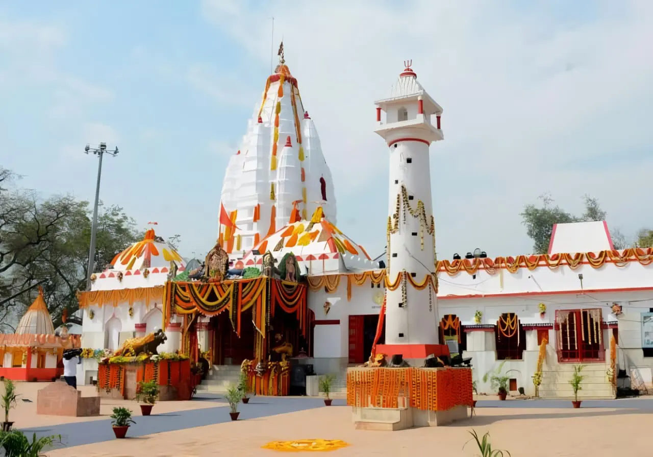
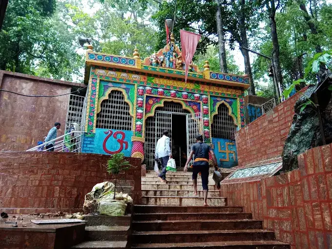
Samaleswari Temple is one of Sambalpur's important religious landmarks. Dedicated to Goddess Samaleswari, the shrine is closely connected with the cultural identity of western Odisha.
Its significance also becomes more apparent when viewed alongside Sambalpur's relationship with the Mahanadi and the traditions that developed in the surrounding region.
Barabati Fort – The Mahanadi and Historic Cuttack
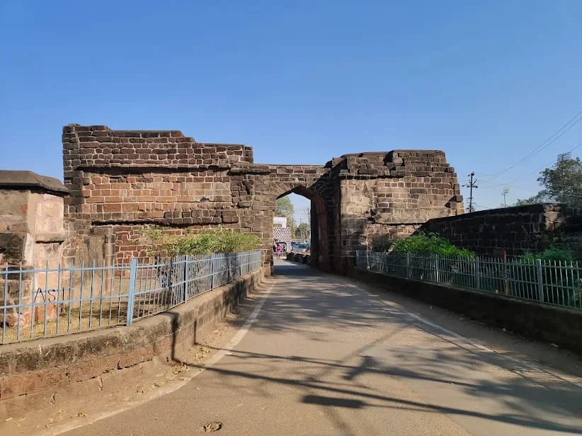
Barabati Fort represents another side of the river story. Cuttack's historical importance was closely connected to its position within the Mahanadi river system, and the fort remains one of the city's most recognisable reminders of its medieval past.
Debrigarh – Where the Reservoir Meets Wildlife
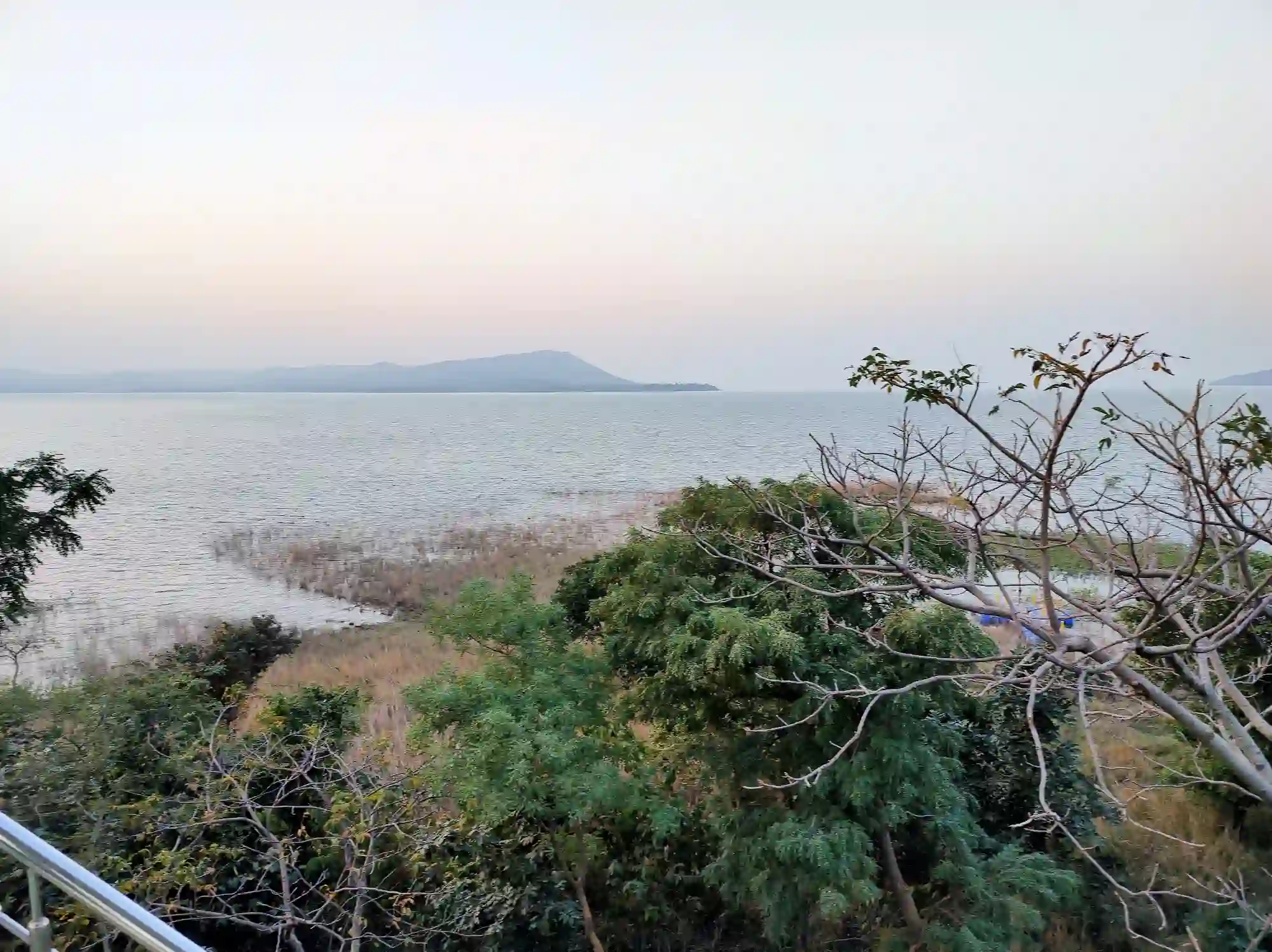
Debrigarh Wildlife Sanctuary, near the Hirakud reservoir, changes the focus again. Here the Mahanadi landscape is associated with forest, hills, water and wildlife rather than only temples or engineering.
The sanctuary is known for wildlife and birdlife, making it a useful stop for travellers who want to see the ecological landscape around the reservoir.
Paradip – Where the River Reaches the Coast
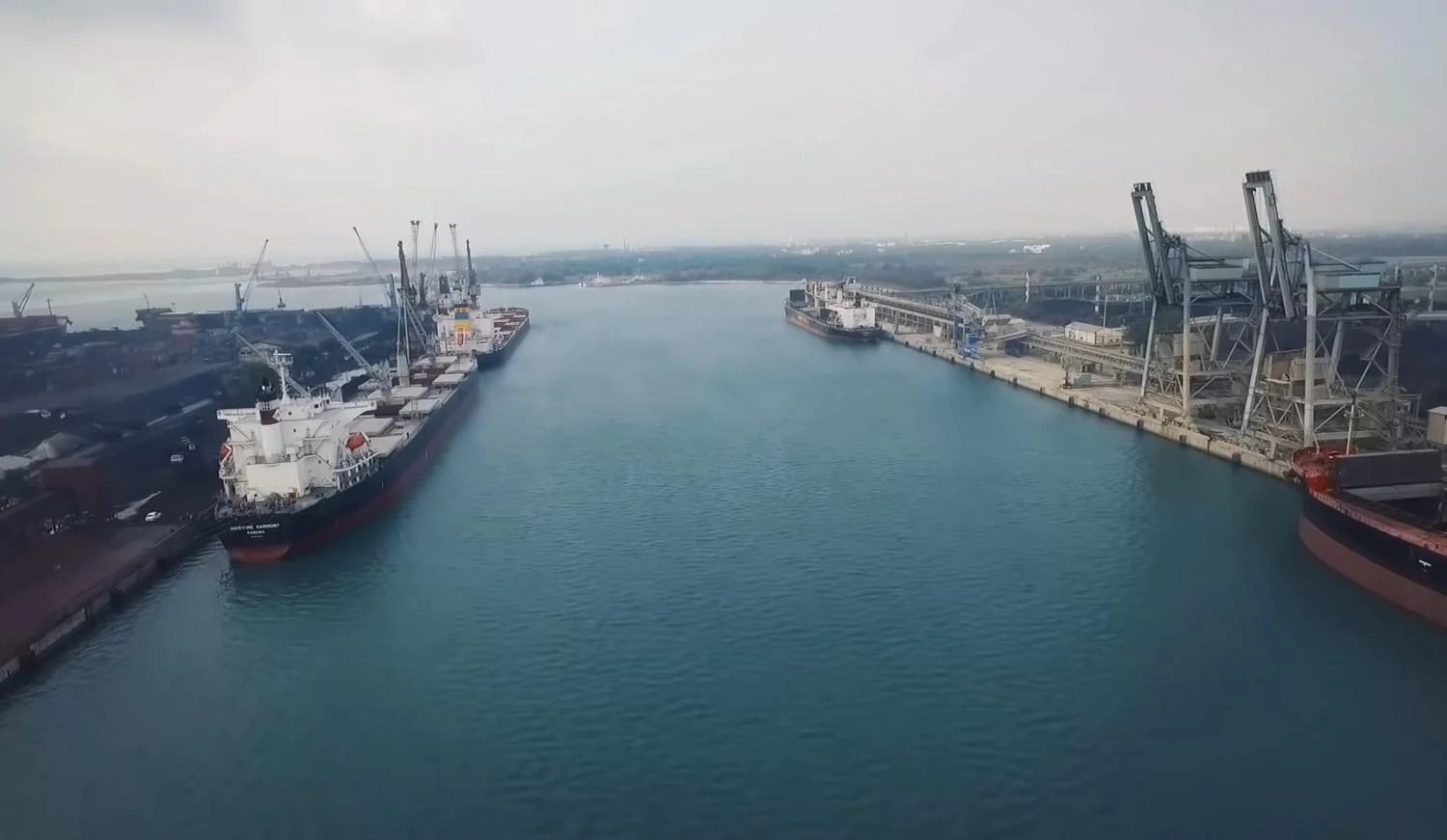
Paradip shows another side of the Mahanadi story. The river system ultimately reaches the Bay of Bengal, bringing the journey from inland hills and reservoirs to Odisha's maritime coast.
The Paradip region also demonstrates how natural geography and modern industry can exist within the same coastal environment.
When Should You Explore the Mahanadi?
There is no single best month for the entire river because the Mahanadi stretches across a large geographical area. For general sightseeing in Odisha, the cooler period is usually easier for outdoor travel.
- October to March: Generally comfortable for sightseeing, photography and outdoor exploration.
- Festival periods: Dates vary each year, but visitors interested in local culture can plan around major festivals such as Nuakhai.
- Monsoon months: Heavy rainfall can dramatically change river levels and road conditions. Anyone visiting riverside areas during this period should check local weather and safety information.
For photography, early morning and late afternoon can provide softer natural light. Around reservoirs and open river landscapes, however, weather conditions matter more than simply choosing a particular hour.
How to Reach the Mahanadi Depends on Which Part You Want to See
For Sambalpur and Hirakud
Sambalpur is the practical base for exploring Hirakud and the western Odisha section of the river. It has railway connections to major cities, while road links provide access to surrounding attractions.
For air travellers, Jharsuguda Airport can be useful for reaching western Odisha, depending on the available flight schedule.
For Cuttack and the Lower Mahanadi
Bhubaneswar is the main air gateway for travellers visiting Cuttack and the lower Mahanadi region. Cuttack itself is well connected by both road and rail.
For the Coastal End of the River System
Travellers exploring the lower river and coastal areas can combine Cuttack and nearby destinations with the Paradip region. The exact route is best planned around the particular places you want to see rather than trying to follow the river continuously.
A Few Things Worth Knowing Before You Go
The Mahanadi is spread across a large area, so conditions can differ significantly between a reservoir, an urban riverbank, a wildlife area and the coast.
- Do not assume every riverbank is a designated tourist area. Access can vary from one location to another.
- During the monsoon, water levels and local conditions can change quickly.
- Carry drinking water and sun protection when visiting open areas around reservoirs or riverbanks.
- Follow local instructions around boating areas and reservoirs.
- Temple visits require respect for local customs and restrictions.
- Do not leave plastic or other waste near the river, forests or heritage sites.
- If you are interested in folklore or local history, speaking with a knowledgeable local guide can provide context that standard tourist descriptions often miss.
People Also Ask About the Mahanadi River
Q1. Why is the Mahanadi River famous?
The Mahanadi is one of eastern India's major rivers and is especially important to Odisha because of its role in agriculture, irrigation, power generation, flood management, settlement and cultural traditions. The Hirakud Dam has also made the river particularly well known.
Q2. Which cities are associated with the Mahanadi?
Important places associated with the Mahanadi and its river system include Sambalpur, Sonepur, Boudh, Banki and Cuttack. The wider river network influences many other settlements across Odisha.
Q3. What is the length of the Mahanadi River?
The Mahanadi is approximately 858 kilometres long. It rises in Chhattisgarh and flows through Odisha before reaching the Bay of Bengal.
Q4. Where does the Mahanadi originate?
The Mahanadi originates near the Sihawa hills in Dhamtari district of Chhattisgarh. It then flows through Chhattisgarh and Odisha before reaching the coast.
Q5. Why is Hirakud Dam important?
Hirakud Dam is a major multipurpose project on the Mahanadi. It was built for purposes including irrigation, flood control and hydroelectric power generation, and its reservoir has become an important feature of the Sambalpur landscape.
Q6. Does the Mahanadi reach the Bay of Bengal?
Yes. The Mahanadi flows through Odisha's lower river system and delta before its waters reach the Bay of Bengal.
Q7. Is the Mahanadi important only for tourism?
No. Tourism is only a small part of its importance. The Mahanadi supports agriculture, irrigation, electricity generation, fisheries, settlements, industry and ecosystems across its basin.
The Mahanadi Is Best Understood as a Living River System
The easiest mistake is to reduce the Mahanadi to one famous image: Hirakud Dam, a wide river near Cuttack or a photograph of water disappearing toward the coast.
The fuller story is much more interesting.
Near its upper reaches, the river belongs to the geography of central India. In Sambalpur, it became part of a landscape transformed by Hirakud and remains intertwined with western Odisha's cultural life. Around Cuttack, its channels help explain the geography and history of one of Odisha's oldest major cities. Downstream, the river becomes part of a delta before reaching the Bay of Bengal.
That is why the Mahanadi deserves attention beyond a conventional sightseeing list. Its course reveals how water can shape land, cities, agriculture, culture, engineering and livelihoods at the same time.
If you travel along even a small part of it, the river may look different from what you expected. That changing landscape is not a side detail of the Mahanadi story. It is the story.