Trip facts
District
From Koraput town
About 55–60 km
Nearest railway station
Damanjodi (~45 km) or Koraput (~58 km)
Nearest airport
Visakhapatnam (~195 km) or Jeypore (~75 km)
Best time
October to March
Rising above the southern highlands of Koraput district, Deomali is the highest mountain peak in Odisha. At an elevation of 1,672 metres (5,486 feet) above sea level, this imposing crest forms part of the Chandragiri-Pottangi sub-range of the Eastern Ghats. Unlike heavily commercialised hill stations elsewhere in India, Deomali remains defined by vast open grasslands, deep gorges, and cool mountain air that sweeps across the undulating valleys.
Located approximately 55–60 km from Koraput town, Deomali offers travellers a rare balance: an accessible high-altitude landscape paired with the rich, living cultural fabric of southern Odisha’s indigenous communities. Whether you are driving up for an early morning sunrise above the cloud bank or spending a quiet weekend exploring the broader Pottangi and Semiliguda belt, Deomali reveals a side of Odisha that many coastal travellers never get to see.Table of Contents
The Natural Splendour of Deomali Hills

The topography of Deomali differs significantly from the northern hills of Odisha. The summit itself is predominantly characterised by bare, grassy tablelands and rounded ridges shaped by wind and weather over millennia. Down in the folds and ravines, semi-evergreen and moist deciduous forests cling to the slopes, feeding seasonal streams that eventually drain into the Kolab and Machkund river basins.
A few defining natural features set this landscape apart:
- High-Altitude Shola-like Grasslands: The upper reaches feature expansive montane grass cover that turns emerald green after the monsoon rains and fades to warm amber by late winter.
- Microclimate & Thermal Relief: Due to its 1,672-metre elevation, temperatures on Deomali stay between 5°C and 8°C cooler than the coastal plains year-round, often dipping below 5°C on clear December and January nights.
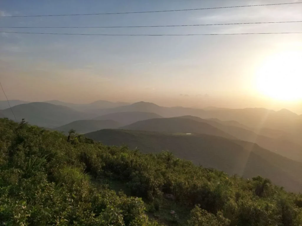
- Cloud Inversions: Between October and December, early morning visitors frequently witness dense blankets of fog sitting in the valleys below while the peak stands clear in the morning sun.
- Watershed Importance: The surrounding hills act as a vital catchment area for regional water bodies, sustaining downstream agriculture across the Koraput and Pottangi plateaus.
Cultural Significance and Tribal Heritage

The hills surrounding Deomali are not an empty wilderness; they are ancestral homelands to several of Odisha’s distinct indigenous communities, primarily the Paraja, Gadaba, and Kondh. These communities possess deep ecological knowledge developed over generations, maintaining sustainable agro-forestry systems and terraces along the hill slopes.
Unlike conventional tourist circuits where culture is performed for visitors, daily life in the villages around Semiliguda, Pottangi, and Kunduli follows agricultural rhythms. The weekly rural markets, known locally as haats, are central to community life. The Friday market at Kunduli—located along the highway corridor leading toward Deomali—is the largest rural haat in the region, where farmers gather to trade hill produce, native ginger, wild turmeric, and handcrafted tools.
Traditional Food & the Highland Culinary Experience
Food in the Koraput highlands is shaped by rainfed agriculture, forest gathering, and cold mountain weather. Exploring the regional food landscape offers meaningful insight into local life:
- Millet Staples: Finger millet (mandia) is an everyday staple across Koraput. Travellers can find mandia jau (a cooling, fermented or warm ragi gruel), steamed mandia pitha, and little millet (suan) porridge. These grains provide sustained energy in the high-altitude terrain and reflect the region’s pioneering role in millet conservation.
- Bamboo Cooking: In rural dhabas around Semiliguda and Kunduli, chicken seasoned with crushed garlic, green chillies, and native wild herbs is packed into fresh green bamboo stems and roasted slowly over wood charcoal embers. The bamboo imparts a subtle woody sweetness without requiring excess oil.
- Forest Produce & Desi Maize: Depending on the season, local markets feature tender bamboo shoots (kardi), wild leafy greens (dungulia saga), forest tubers, and open-roasted sweet corn sold by roadside farmers.
- Mahua (Mohulo) Context: In early spring, the cream-coloured blossoms of the Madhuca longifolia tree are gathered from forest floors. Among local communities, mahua is not an illicit novelty; it is a respected traditional resource. Dried blossoms are cooked into festive breads, while a traditional fermented spirit is prepared for customary gatherings and sacred village rituals. It remains part of community hospitality and seasonal ceremonies, rather than a commercial commodity.
Practical Dining Advice for Travellers: There are no permanent restaurants, cafes, or dining stalls at the summit of Deomali. Small temporary kiosks near the parking lot sell only tea, boiled eggs, roasted corn, and packaged water during day hours. Plan your meals at Semiliguda town, halt at Kunduli along the highway, or carry your own food and carry all wrappers and waste back down the mountain.
Responsible Cultural Etiquette
When travelling through villages around Deomali, observe fundamental courtesies. Always ask for clear, verbal permission before taking photographs of local residents, especially women and village elders. Respect village pathways, sacred groves (known as Jaher or Dharani shrines), and private courtyards. Treat local interactions as mutual human encounters rather than tourist photo opportunities.
Adventure and the Summit Walk at Deomali

One common misconception in generic travel guides is that reaching Deomali requires an arduous 4-hour trek from distant towns like Lamtaput. In reality, a well-engineered motorable road winds directly up the mountain to a designated parking area near the Odisha Tourism eco-cottages, located just below the crest.
Understanding the actual terrain helps you plan properly:
- The Summit Walk (Paved Trail): From the upper parking area, a stone-paved walkway with protective railings ascends approximately 600 to 800 metres to the highest observation point. This walk takes roughly 15 to 25 minutes of steady uphill walking. It is manageable for families and casual walkers, though comfortable walking shoes with good grip are recommended on windy days.
- Downhill Ridge Hiking: For experienced trekkers, the long rolling ridges running southwest offer hours of open walking across high-altitude grasslands with continuous 360-degree views of the Koraput valley.
- Village Base Trails: Hikers seeking a traditional ascent can leave their vehicles at the lower foothill hamlets near Doliamba or Talaghol and follow ancestral cattle and foot trails through scrub and forest up to the ridge (a 2.5- to 3.5-hour climb with a 500-metre elevation gain). Always hire a knowledgeable local guide if taking these unmarked routes.
- High-Altitude Camping: Overnight camping in independent tents on the bare summit is restricted due to strong gale-force winds and forest safety regulations. Travellers wishing to stay overnight on the mountain should book the official eco-cottages managed by the local forest community committee through the Odisha Eco-Tourism portal.
Flora and Fauna of Deomali

Deomali’s ecosystem forms an important ecological bridge within the northern Eastern Ghats. The transition from moist sal-dominated foothill forests to open montane grasslands creates niche micro-habitats for diverse plant and animal life.
Key ecological highlights include:
- Plant Diversity: Over 200 species of medicinal plants thrive across the slopes, including wild ginger, ground orchids, wild asparagus (satavari), and rare lichens that cling to exposed rock faces.
- Birdlife: The open ridges and valley forests are productive grounds for birdwatchers. Resident species include the Crested Serpent Eagle, Indian Blackbird, Malabar Whistling Thrush, and various pipits and larks feeding along the grassy slopes.
- Mammals: While large wildlife avoids the frequently visited peak, the surrounding reserve forests harbour barking deer (muntjac), wild boars, Indian hares, and occasional leopard movement across undisturbed corridors.
- Conservation & Plastic Ban: Koraput’s highland ecology is fragile. The district administration and local eco-development committees actively enforce a strict anti-littering and plastic restriction policy. Every visitor is expected to leave zero trash behind.
Best Time to Visit Deomali Hills

The optimal window to visit Deomali Hills is between October and March, when the monsoon rains have cleared and daytime temperatures remain comfortably cool.
- Winter (November to February): The most popular season. Clear blue skies provide visibility across several mountain chains. Morning temperatures often hover between 4°C and 10°C, requiring warm jackets, woollen caps, and windcheaters. Sunrise visits during these months are particularly rewarding.
- Post-Monsoon (October to Early November): The hills are covered in fresh green grass, seasonal waterfalls in the surrounding valleys flow strongly, and misty clouds frequently roll over the access roads.
- Monsoon (July to September): While visually stunning, heavy rainfall can cause reduced visibility, thick fog that blankets the roads, and slippery stone pathways. Driving on the narrow ghat curves requires extra caution.
- Summer (April to June): Daytime temperatures in the valleys can exceed 34°C, though the peak remains breezy. If visiting in summer, plan your excursion between 5:30 AM and 9:00 AM or after 4:00 PM to avoid the midday sun.
Things to Do at Deomali
- Watch the Sunrise Above the Cloud Line: Arriving at the peak before 5:30 AM in winter allows you to watch the sun rise over a sea of white morning mist filling the lower valleys.
- Walk the Ridge Line: Follow the marked stone trails beyond the main viewing platform to find quiet spots looking out across the Koraput and Andhra Pradesh borders.
- Landscape Photography: Capture the interplay of shifting cloud shadows across the sweeping green slopes and winding mountain road.
- Visit the Kunduli Friday Haat: Combine your hill visit with a stop at Kunduli to experience the vibrant rural economy and pick up fresh hill spices and seasonal produce.
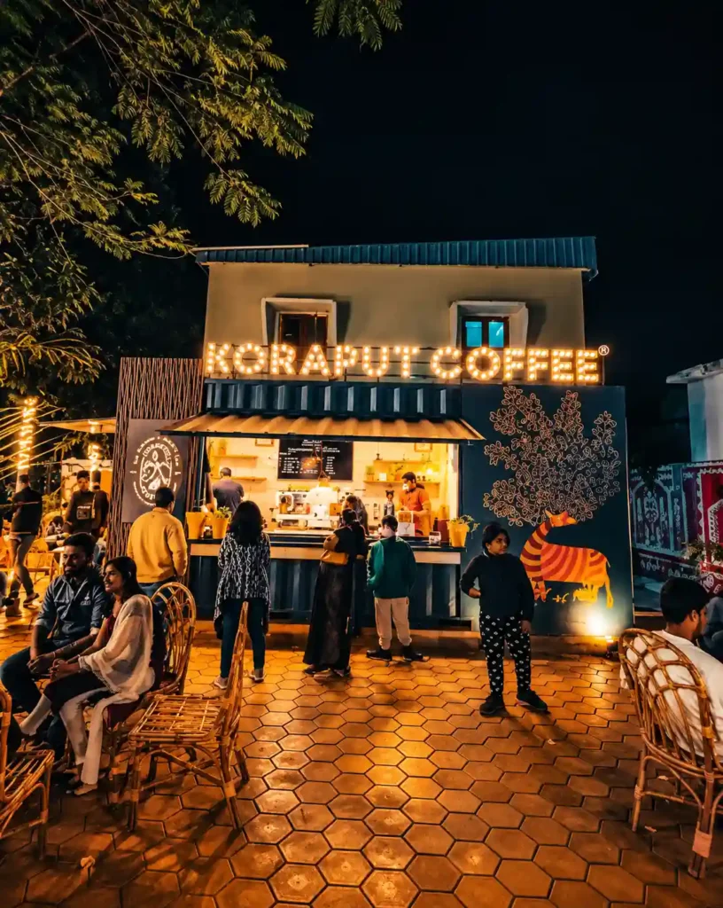
- Sip Fresh Koraput Coffee: On your drive back down through Semiliguda or Koraput town, stop at a local cafe or outlet to sample freshly brewed Koraput Coffee, grown on the highland slopes of this district.
Nearby Attractions Around Deomali Hills

Because Deomali takes around half a day to explore, combining it with other key destinations across Koraput makes for a rewarding circuit:
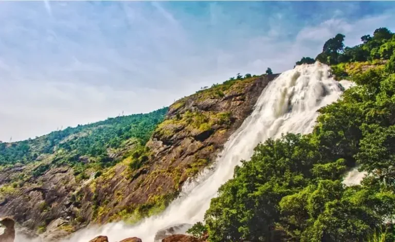
- Duduma Waterfall (Machkund River, ~90 km from Deomali): Plunging 175 metres down a rocky gorge on the Odisha-Andhra border, Duduma is among the highest waterfalls in India and one of southern Odisha’s most dramatic natural sights.
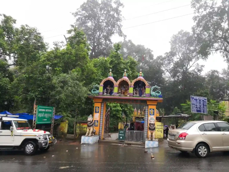
- Sabara Srikhetra Jagannath Temple, Koraput Town (55–60 km): Built on a peaceful hilltop, this temple honours Lord Jagannath’s tribal roots and operates with an inclusive philosophy welcoming visitors of all backgrounds.
- Punjisil Waterfall: A secluded forest cascade set within quiet woods near Koraput, ideal for travellers seeking uncrowded nature trails.
- Gupteswar Cave Temple (~110 km from Deomali): A sacred limestone cave nestled inside dense sal forests along the Kolab River, featuring an impressive natural Shiva lingam.
- Kolab Reservoir & Botanical Garden (~65 km): A vast water reservoir surrounded by rocky hills, offering serene sunset views and manicured garden paths.
Travel Tips for a Safe Visit
- Footwear Matters: Wear sturdy walking shoes or sneakers with dependable rubber grip. The stone paths can be slick with morning dew, and grass slopes are uneven.
- Pack Wind-Resistant Layers: Wind speeds at 1,672 metres can be strong and chilly even on sunny winter days. Carry a lightweight windbreaker or warm fleece.
- Fuel Up Early: The last reliable petrol pumps are located in Semiliguda town. Ensure your vehicle has adequate fuel before beginning the 25-kilometre mountain climb.
- Mobile Network Coverage: BSNL and Jio offer intermittent signals near the peak; Airtel connectivity can be weak or absent along parts of the ghat road. Download offline maps beforehand.
- Avoid Night Driving on the Ghat: The mountain road lacks street lighting and features several sharp hairpin bends. Plan your descent before sunset unless you are staying at the summit eco-cottages.
- Carry Back Your Trash: There is no municipal waste collection at the summit. Always carry a small bag in your car to pack out empty water bottles and snack packets.
How to Reach Deomali Hills Odisha
Planning a trip to Deomali requires understanding that this is a remote highland journey rather than a quick suburban sightseeing drive. While the total distance from Koraput town is only 55 to 60 km, the final 20 kilometres involve narrow ghat ascents, single-lane village roads, and several blind hairpin curves that demand unhurried, cautious driving. Factor in weather changes, morning fog, and scenic stops along the valley when mapping out your itinerary, and allow at least 1.5 to 2 hours for the one-way road trip from Koraput.
| Travel Parameter | Logistical Details |
|---|---|
| Geographic Location | Pottangi block, Koraput district, Southern Odisha |
| Summit Elevation | 1,672 metres (5,486 ft) — Highest peak in Odisha |
| Distance from Koraput Town | 55–60 km (approx. 1.5 to 2 hours drive via NH-26) |
| Nearest Commercial Hub | Semiliguda (~35–40 km) / Sunabeda (~45 km) |
| Recommended Route | Koraput → NH-26 through Sunabeda & Semiliguda → Kunduli → Turn toward Doliamba → Deomali Hill Road |
| Nearest Railway Stations | Damanjodi (~45 km), Koraput Junction (~58 km) |
| Nearest Airports | Visakhapatnam Airport (VTZ, ~195 km) / Jeypore Airport (PYB, regional, ~75 km) |
| Road Condition & Vehicle Suitability | Paved asphalt all the way to upper parking; suitable for cars, SUVs, and standard motorcycles |
Step-by-Step Route Directions
- From Koraput Town: Head south-east along National Highway 26 (NH-26) past Sunabeda town and the HAL industrial campus toward Semiliguda.
- At Semiliguda: Continue along NH-26 towards Salur/Visakhapatnam for approximately 15 km until reaching Kunduli.
- The Deomali Turn-Off: Just past Kunduli, watch for the marked Odisha Tourism signage indicating the left turn toward Doliamba and Deomali.
- The Ghat Ascent: Follow the newly widened single-lane asphalt road through rural hamlets and up the serpentine hill bends to the upper parking area and tourist complex.
Why Deomali Hills Should Be on Your Travel List

Unlike crowded commercial hill stations in northern India lined with high-rise hotels and noisy souvenir stalls, Deomali preserves an elemental, raw connection with nature. What makes this corner of the Eastern Ghats of Odisha memorable is its quiet dignity: the wind rushing through the tall mountain grass, the distant patchwork of tribal agricultural terraces, and the absence of urban distraction.
When I trekked to the summit, the view of endless hills fading into the horizon felt like standing at the edge of the world. That moment alone was worth the journey.
Deomali invites you to slow down, respect the land, breathe unpolluted mountain air, and witness the rugged heartland of southern Odisha at its finest.
People Also Ask: Common Questions About Deomali Hills
Q1. Where is Deomali located?
Deomali is located in Pottangi block of Koraput district in southern Odisha. It lies approximately 55–60 km from Koraput town and roughly 35 km from Semiliguda, within the Chandragiri-Pottangi hill range of the Eastern Ghats.
Q2. What is the height of Deomali peak?
Deomali stands at an elevation of 1,672 metres (5,486 feet) above mean sea level, making it the highest mountain peak in the state of Odisha.
Q3. What is the best time to visit Deomali?
The best time to visit is between October and March. Winter months (November to February) bring clear skies, pleasant daytime weather, and crisp morning temperatures ranging between 4°C and 12°C, ideal for summit viewing and photography.
Q4. How can I reach Deomali from Koraput?
From Koraput town, drive south-east along NH-26 via Sunabeda and Semiliguda to Kunduli, then turn onto the hill road toward Doliamba. The distance is roughly 55–60 km and takes about 1.5 to 2 hours by private car, taxi, or motorcycle.
Q5. Can vehicles go all the way to the top of Deomali?
Paved motorable roads lead directly to the upper parking lot and eco-tourism cottages just below the summit ridge. From the parking area, visitors walk a stone-paved path with safety railings for about 15 to 20 minutes to reach the highest observation point.
Plan Your Journey to the Crown of Odisha
Deomali Hills represents the quiet summit of Odisha’s wild geography. Between the winding ghat drives, the early morning cloud inversions, and the resilient cultural life of the Koraput plateau, a journey here offers genuine perspective. Pack your walking shoes, respect the local communities, leave nothing behind on the hills, and experience the highest heights southern Odisha has to offer.
Related guide: Craving cooler air? Explore more hill stations in Odisha in our complete guide.