Trip facts
Location
Southern Odisha, Eastern Ghats
Area
About 8,807 sq km
Highest peak
Deomali, about 1,672 m
From Bhubaneswar
About 499 km
Nearest airport
Visakhapatnam, about 202 km
Best time
All year; winter is coolest
The district is more than a hill destination. Its history stretches from ancient religious traditions and the Nandapur kingdom to the formation of modern Odisha. Its landscape includes the Deomali hills, Kolab and Machkund river systems, waterfalls such as Duduma, and forested valleys associated with the cultural traditions of numerous tribal communities.
The Odisha District Gazetteer describes Koraput as a region where nature, traditional life and modern development coexist. The district has also been associated with the legendary Dandakaranya described in the Ramayana.
Where is Koraput in Odisha?
Koraput is a district in southern Odisha, situated along the Eastern Ghats. The present district shares boundaries with Nabarangpur to the north, Bastar in Chhattisgarh to the west, Malkangiri to the south, and Vizianagaram and Srikakulam districts of Andhra Pradesh to the east.
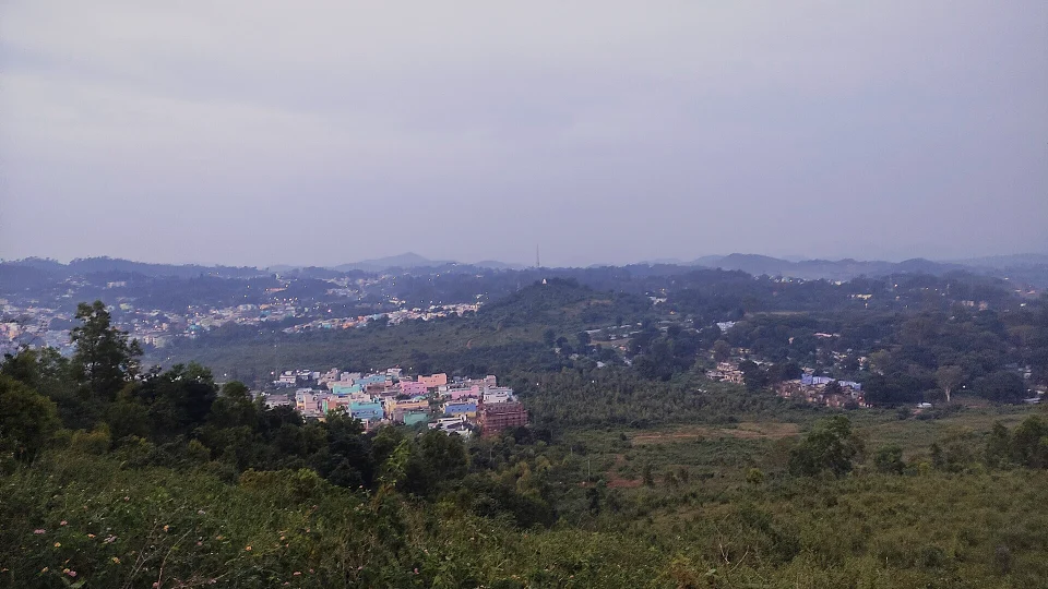
The present Koraput district covers an area of about 8,807 square kilometres, according to the Gazetteer’s district profile based on the 2011 Census.
The district is geographically diverse, with elevated plateaus, hills, valleys, forests and river systems. Much of its character comes from its location in the Eastern Ghats.
Why is Koraput Odisha famous?
Koraput is famous for its:
- Eastern Ghats landscape
- Deomali mountain
- Duduma or Machhkund waterfall
- Gupteswar cave shrine
- Nandapur's historic monuments
- Jeypore's cultural and archaeological heritage
- Tribal Museum
- Tribal festivals and traditions
- Ancient Jain archaeological remains
- Rivers, forests and scenic valleys
- Maliguda railway tunnel
- Kolab and Machkund river systems
- Traditional agriculture and tribal culture
- Koraput Coffee
Best Places to Visit in Koraput Odisha
1. Deomali — The Highest Peak of Odisha
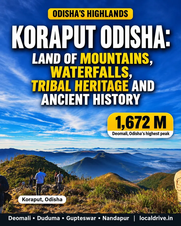
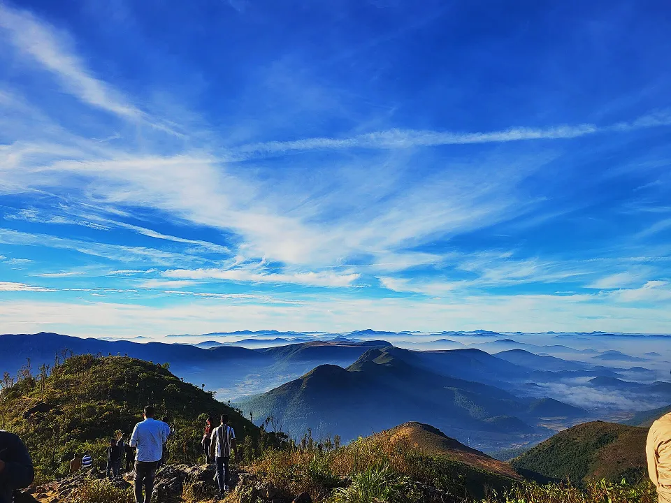
Deomali is one of the biggest attractions in Koraput Odisha. Located in the Eastern Ghats, it is recognised in the Gazetteer as the highest mountain peak in Odisha.
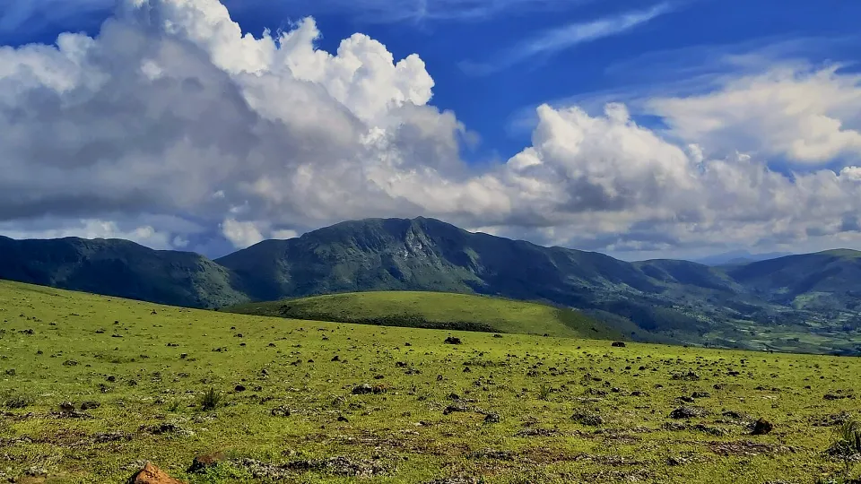
The Gazetteer records Deomali at 1,672.56 metres and notes that it is the highest mountain in both Koraput district and Odisha.
The mountain landscape makes Deomali particularly attractive for trekking and adventure-oriented travel. The tourism section of the Gazetteer also describes Deomali as a suitable location for trekking expeditions and aero-gliding activities.
Why visit Deomali?
- Mountain trekking
- Panoramic Eastern Ghats landscapes
- Sunrise and sunset views
- Photography
- Nature and adventure tourism
For travellers looking for mountains near Koraput, Deomali is one of the most important destinations to include.
2. Gupteswar — The Cave Shrine in the Forest
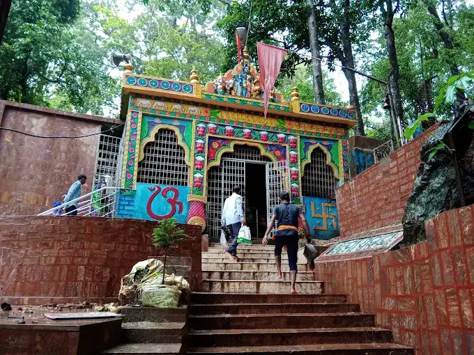
Gupteswar is a famous cave shrine situated amid a forested hill landscape. It is around 80 km from Koraput according to the Gazetteer.
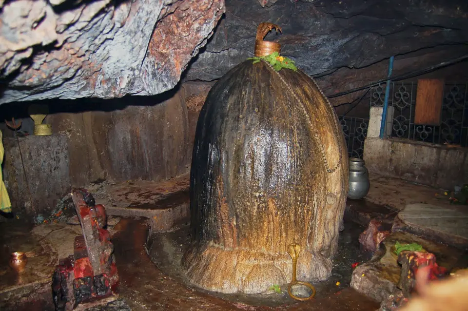
Inside the multi-chambered cave is a large Shiva lingam. The place is also popularly known as Gupta Kedara. The Shabari, a rocky stream, flows through the surrounding landscape, adding to the scenic character of the area.
Gupteswar is also connected with local traditions surrounding Lord Rama's journey through the forest during his exile.
What makes Gupteswar special?
Gupteswar combines:
- Cave architecture
- Shaiva tradition
- Forest landscape
- River scenery
- Local legends
- Pilgrimage and nature tourism
3. Duduma Falls or Machhkund Waterfall
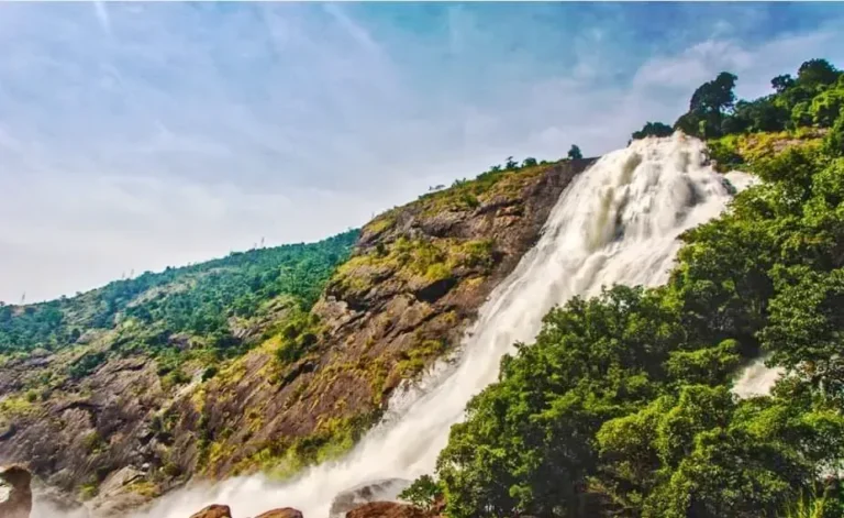
Duduma Falls, associated with the Machkund River, is one of the spectacular waterfalls of the Koraput region.
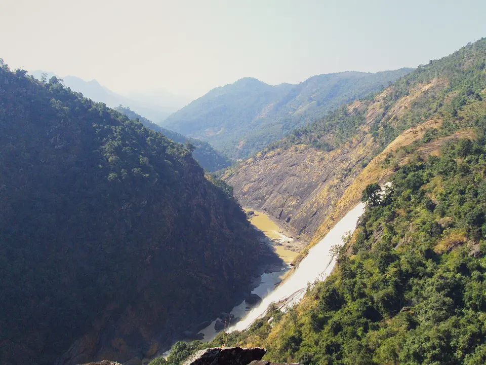
The Gazetteer describes Duduma as a majestic waterfall falling from approximately 175 metres amid a picturesque hill landscape. It is also known as Matsya Tirtha. The waterfall is around 88 km from Koraput according to the tourism information in the Gazetteer.
The surrounding Machkund region is also historically important because of the Machhakund Hydroelectric Project, a joint project associated with Odisha and Andhra Pradesh.
4. Nandapur — The Ancient Capital of the Jeypore Kingdom
For travellers interested in Koraput history, Nandapur is one of the most important places to explore.
Nandapur became the capital under the Silavamsi kings and later remained closely connected with the history of the Jeypore kingdom. The capital was subsequently shifted to Jeypore in the 17th century under Vira Vikrama Deo.
Nandapur is particularly known for the Batrisa Sinhasana, or the famous thirty-two-step throne. The Gazetteer also mentions an imposing Ganesha image, Bhairavnath shrine and other monuments of historical significance.
Nandapur is also important from the perspective of Jain archaeology. The region around the Issani Ganga has been identified as an important centre of Jainism, with archaeological remains reflecting South Indian influence.
5. Jeypore — History, Culture and Archaeology
Jeypore is one of the major historic towns associated with Koraput.
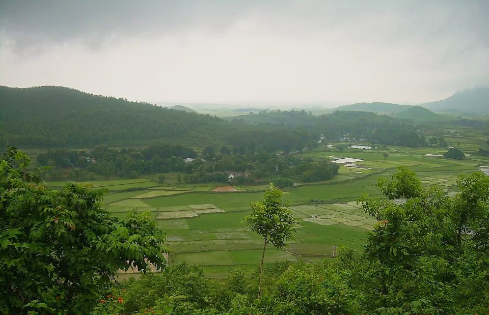
The history of the Jeypore kingdom is closely connected with Nandapur. The capital was eventually shifted from Nandapur to Jeypore during the 17th century, and Jeypore developed into an important town.
Jeypore is also significant for its archaeological heritage. Several Jain sculptures and relics have been found in and around the town, and the District Museum at Jeypore houses Jain sculptures collected from different parts of the district.
6. Koraput Tribal Museum
The Tribal Museum in Koraput provides an introduction to the cultural heritage of the tribal communities of the region.

The Gazetteer describes the museum as a place containing mineral samples, tribal costumes, handwoven clothes and musical instruments. Located behind the Jagannath Temple in Koraput, it helps visitors understand the cultural heritage of the region.
For anyone exploring Koraput tribal culture, the museum is an important starting point.
7. Sabar Srikhetra and Jagannath Temple, Koraput
The Jagannath Temple, popularly associated with Sabar Srikhetra, is located on a hillock in the heart of Koraput town.
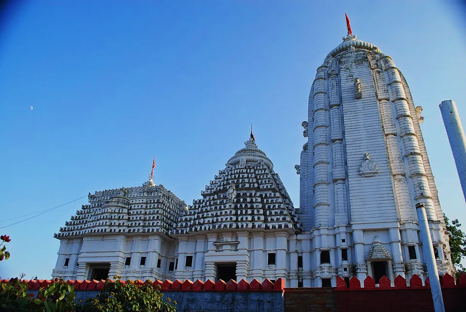
The temple adds an important spiritual dimension to the town's identity, while the adjoining Tribal Museum provides visitors with a glimpse into the cultural heritage of the region.
Together, these places offer a combination of spirituality, local culture and heritage.
8. Maliguda Railway Tunnel
Maliguda is another interesting destination for visitors exploring Koraput.
The Gazetteer describes Maliguda as a small village located about 25 km from Koraput, where a railway tunnel passes through a hill. It is identified in the tourism section as a suitable place for a weekend picnic.
Its railway heritage makes Maliguda particularly interesting for travellers fascinated by engineering, railways and mountain landscapes.
9. Bagra Waterfalls
Bagra is located around 18 km from Koraput and is associated with three waterfalls formed by the Kolab River.
The Gazetteer describes the waterfalls as plunging over rocky terrain and identifies the area as a scenic destination.
For those searching for waterfalls near Koraput, Bagra can be included along with Duduma and other natural attractions.
10. Raniguda
Raniguda is another destination mentioned in the district's tourism section. Located about 18 km from Koraput, it is described as a place suitable for weekend picnics, adventure and eco-tourism.
Koraput's Rivers and Mountains
The geography of Koraput is dominated by hills, plateaus, rivers and perennial streams.

The district lies in the Eastern Ghats and contains several important mountain ranges. Besides Deomali, the Gazetteer lists peaks such as Karnapadi Dongar, Meyamali Parbat, Turia Dongar, Polamakani Parbat and Sirimanda Parbat.
Four major river systems drain much of the district:
- Indravati
- Kolab
- Machkund
- Champabati or Jhanjabati
These rivers and their tributaries flow through the hills and valleys, shaping the landscape of Koraput.
The Unique Degree Confluence Point of Koraput
One of the lesser-known geographical curiosities of Koraput is the latitude-longitude confluence point near Maligam in Laxmipur Block.
According to the Gazetteer, the point is located near the Murani River at approximately 19°00′00″ N and 83°00′00″ E. The point lies in the middle of the river, surrounded by small hills.
This makes the area an unusual geographical feature within Koraput district.
Koraput's Tribal Culture and Festivals
Koraput's identity cannot be understood without its tribal communities and their traditions.
The district is home to numerous tribal communities, each with distinctive customs, festivals, languages, music, dance and social traditions. The Gazetteer describes the region as a place where different tribal communities have maintained distinct identities while adapting to changing times.
Chaita Parab
Chaita Parab is described in the Gazetteer as one of the grand festivals of the Koraput region. It is observed by tribal communities during Chaitra, generally corresponding to March-April.
The festival includes dancing, singing, community celebrations, rituals and the welcoming of the agricultural season.
Pus Parab
Pus Parab is another important festival celebrated by communities including Bhumia, Bhattra, Pentia, Parenga, Gadaba, Durua and Paroja, as well as other communities of the region.
The festival is associated with dancing, singing, village visits, feasting and community bonding.
Parab Festival
The larger Parab festival is described as an annual tribal festival organised across the district, with programmes involving sports, culture, seminars, mountain trekking, boat races, artist camps, crafts fairs and exhibitions.
Koraput's Ancient Jain Heritage
One of the most fascinating aspects of Koraput's heritage is its Jain archaeological history.
The Gazetteer records Jain antiquities and monuments across numerous locations in the district. Jainism is described as having entered the Kalinga region in the 6th century BCE and continuing under royal patronage into the medieval period.
Important Jain archaeological locations include:
- Nandapur
- Subaee
- Kachela
- Bhairabasingpur
- Jeypore
- Kotpad
- Borigumma
- Jamunda
- Phampuni
- Ambavalli
- Goriahandi
- Several other villages and archaeological sites
The Gazetteer notes that the District Museum at Jeypore houses Jain sculptures collected from several of these locations.
Subaee Jain Monument
Subaee contains the remains of Jain shrines with sculptures of Tirthankaras and Sasanadevis. The site is particularly notable for its archaeological and iconographic importance.
Kachela Jain Heritage
Kachela, situated near the Kolab River, was once an important Jain centre. The remains of a Jain temple were documented near the foot of Deo Donger hill, although the heritage structure was subsequently affected by the Kolab reservoir.
This archaeological layer makes Koraput much more than a nature destination—it is also an important landscape for the study of India's religious and cultural history.
What is the climate of Koraput Odisha?
Koraput has a distinctive highland climate influenced by its elevation and hilly terrain.
The Gazetteer describes four broad seasons: summer, monsoon, autumn and winter. Summers generally extend from March to May, while the monsoon lasts from June to September. Winter extends from December to February.
The elevated Koraput plateau is generally cooler than the warmer low-lying areas of the district. Winter mornings around Koraput can also be particularly cold and foggy.
What is the best time to visit Koraput Odisha?
The Gazetteer's tourism information states that Koraput can be visited throughout the year.
However, the experience changes considerably by season:
Winter: Pleasant and cooler, particularly suitable for exploring hills and heritage sites.
Summer: Mountain destinations can provide relief from hotter lowland regions, although temperatures vary considerably across the district.
Monsoon: The landscape becomes lush and waterfalls and streams are particularly dramatic, but heavy rainfall can affect travel in remote areas.
Autumn: A transitional period with pleasant landscapes and festival activity.
How to Reach Koraput Odisha?
By Air
The Gazetteer identifies Visakhapatnam Airport as the nearest airport, approximately 202 km from Koraput.
By Train
Koraput has railway connectivity with several major cities. The Gazetteer mentions connections involving Visakhapatnam, Bhubaneswar, Rourkela, Delhi, Chennai and Kolkata, with Rayagada forming an important railway connection in the network described in the document.
By Road
Road connectivity is provided through the highway network passing through the district. The Gazetteer's tourism section specifically mentions NH-26.
How Far is Koraput from Major Cities?
The tourism information in the Gazetteer gives the following approximate distances from Koraput:
| Destination | Approx. distance |
|---|---|
| Bhubaneswar | 499 km |
| Visakhapatnam | 202 km |
| Berhampur | 320 km |
| Raipur | 400 km |
| Jagdalpur | 115 km |
| Jeypore | 22 km |
| Sunabeda | 18 km |
| Nandapur | 45 km |
| Gupteswar | 80 km |
| Duduma | 88 km |
| Maliguda | 25 km |
| Jolaput | 77 km |
| Subai | 34 km |
These figures are from the tourism information contained in the Koraput District Gazetteer.
What Makes Koraput Different from Other Tourist Destinations in Odisha?
Koraput stands out because several different layers of Odisha come together in one landscape.
It has:
Nature: Eastern Ghats, mountains, rivers, forests and waterfalls.
Adventure: Deomali trekking, mountain landscapes and outdoor exploration.
Spirituality: Gupteswar and Sabar Srikhetra.
History: Nandapur and the history of the Jeypore kingdom.
Archaeology: Jain, Buddhist and Hindu remains.
Tribal heritage: Diverse communities, languages, festivals, music, dance and traditional practices.
Modern development: Industries and infrastructure such as HAL, NALCO and hydroelectric projects also form part of the district's modern history.
This combination of ancient heritage, living culture, dramatic geography and modern development gives Koraput a character that is difficult to reduce to a single tourism category.
Frequently Asked Questions About Koraput Odisha
What is Koraput Odisha famous for?
Koraput is famous for its mountains, waterfalls, forests, tribal culture, ancient heritage, Deomali peak, Gupteswar cave shrine, Duduma Falls, Nandapur, Jeypore and Jain archaeological remains.
Is Koraput worth visiting?
Yes. Koraput offers a combination of nature, adventure, history, archaeology, spirituality and tribal culture. It is particularly attractive for travellers looking for destinations beyond conventional coastal Odisha.
Which is the highest peak in Koraput?
Deomali is the highest peak in Koraput district and is identified in the Gazetteer as the highest mountain peak in Odisha. The Gazetteer records its height at about 1,672.56 metres.
What are the best places to visit in Koraput?
Some of the important places to explore include Deomali, Gupteswar, Duduma Falls, Nandapur, Jeypore, Sabar Srikhetra, the Tribal Museum, Maliguda, Bagra and Raniguda.
Which waterfall is famous in Koraput?
Duduma Falls, also known as Machhkund or associated with Matsya Tirtha, is one of the best-known waterfalls of the Koraput region. The Gazetteer describes it as approximately 175 metres high.
Which mountain is famous in Koraput?
Deomali is the most famous mountain of Koraput and the highest peak in Odisha according to the Gazetteer.
What is Koraput's famous temple?
Important religious destinations include the Gupteswar cave shrine and Sabar Srikhetra/Jagannath Temple in Koraput town. Gupteswar is a forested cave shrine associated with Lord Shiva, while Sabar Srikhetra is located on a hillock in the town.
Why is Nandapur famous?
Nandapur is famous for its historical association with the Jeypore kingdom and for monuments including the Batrisa Sinhasana, an ancient thirty-two-step throne, along with other temples and archaeological remains.
Is Koraput famous for tribal culture?
Yes. Tribal communities form an important part of Koraput's cultural identity. The district has distinctive tribal festivals, languages, music, dances, customs and traditional practices. The Tribal Museum in Koraput documents aspects of this heritage.
What is Parab in Koraput?
Parab is an annual tribal festival celebrated across Koraput. According to the Gazetteer, its programme includes cultural events, sports, seminars, trekking, boat races, artist camps, crafts fairs and exhibitions.
What is Koraput's connection with Jainism?
Koraput has extensive Jain archaeological remains. The Gazetteer identifies several Jain centres including Nandapur, Subaee, Kachela, Bhairabasingpur, Jeypore and other locations. It describes Nandapur as an important historic centre of Jain religion.
Is Koraput part of the Eastern Ghats?
Yes. Koraput lies in the Eastern Ghats and contains elevated plateaus, mountain ranges and numerous hills. Deomali is its highest peak.
Which rivers flow through Koraput?
The major river systems of Koraput are the Indravati, Kolab, Machkund and Champabati or Jhanjabati, along with their tributaries.
What is Koraput's climate like?
Koraput has a tropical to sub-tropical highland climate influenced by elevation and hills. It experiences summer, monsoon, autumn and winter seasons, with cooler conditions around the elevated Koraput plateau.
Can Koraput be visited throughout the year?
The tourism information in the Gazetteer states that Koraput can be visited throughout the year.
How far is Koraput from Bhubaneswar?
The Gazetteer's tourism section gives the distance between Bhubaneswar and Koraput as approximately 499 km.
How far is Visakhapatnam from Koraput?
The Gazetteer gives the distance from Koraput to Visakhapatnam as approximately 202 km and identifies Visakhapatnam as the nearest airport in its tourism information.
What is Koraput's unique geographical feature?
A notable geographical feature is the latitude-longitude degree confluence point near Maligam, close to the Murani River, at approximately 19°00′00″ N and 83°00′00″ E.
Koraput Odisha: Where Nature and Memory Meet
Koraput is not simply a destination marked by mountains and waterfalls. It is a landscape shaped by centuries of movement, settlement, kingdoms, religious traditions, tribal communities, rivers and forests.
The district's history connects Nandapur with Jeypore, while its archaeological landscape preserves evidence of Jain and Buddhist traditions alongside Hindu places of worship. Its mountains and rivers create a dramatic natural setting, while its festivals and living communities keep its cultural landscape vibrant.
Perhaps the most compelling way to understand Koraput Odisha is to see it as a meeting point of different worlds: ancient and modern, mountain and valley, forest and settlement, archaeology and living tradition.
For travellers willing to look beyond the familiar tourist circuit of Odisha, Koraput offers something rare—a destination where the journey through nature is also a journey through history and culture.
Quick Koraput Travel Snapshot
| Location | Southern Odisha, Eastern Ghats |
| District headquarters | Koraput |
| Area | 8,807 sq. km |
| Highest peak | Deomali |
| Major rivers | Indravati, Kolab, Machkund and Champabati/Jhanjabati |
| Famous waterfall | Duduma/Machhkund |
| Famous cave shrine | Gupteswar |
| Historic centre | Nandapur |
| Major historic town | Jeypore |
| Cultural attraction | Tribal Museum |
| Major tribal festival | Parab |
| Railway attraction | Maliguda |
| Nearest airport | Visakhapatnam |
| Best season | Throughout the year |
Photos: Wikimedia Commons, colour-graded by LocalDrive. By Shubsclicks (CC BY 4.0); Panigrahiasmitku (CC BY-SA 4.0); BubunTalk (CC BY-SA 4.0); Indopaedia (CC BY-SA 4.0); Bitan.ari (CC BY-SA 4.0); SergeiBuls (CC BY 3.0); Subhashish Panigrahi (CC BY-SA 4.0); Drashokk (CC BY-SA 4.0); Parthapratim25 (CC BY-SA 4.0).
Related guide: Browse all our Koraput stories.